I am enamored by aerial photography. The patterns one can see from above are different and mostly are left unknown to the ordinary viewer on the ground. The earth from above takes on a whole new form. No wonder a lot of people attribute to flying as a spiritual experience.
Being a frequent flyer, I always try to get that window seat that provides the best view of the earth down below. But getting that right spot in the plane, away from the obstructing wing, is easier said than done. Luck plays a great deal in getting that enviable seat. Over the years of flying, I’ve learned some tricks of the trade which I am sharing here.
1. Study the flight direction against the map. Is the direction going northeast or directly west? If you’re a sunrise and sunset hound, determine which side of the plane faces west or east. What are the most likely attractions that one can pass? Short of asking the pilot, the actual flight path can only be acquired by experience so if you would take the same flight sometime in the future, check out now what the sights are below.
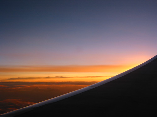
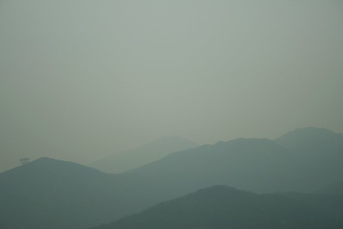
2. Be conscious of the flying time and the direction of the light. Sometimes, I purposely would sit where the sun is at the other side to get strong backlights against bodies of water. Check the weather too of your port of embarkation and the place of destination. Aerial photography is impossible in bad weather.
3. Be early in the airport. If it is possible to book a seat before the actual flight do so. International carriers allow you to choose a seat online although some of the good seats are often blocked. I have not tried this with domestic Philippines airlines which don't offer this service yet.
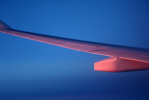
4. If you cannot get a window seat at the front, a section often reserved for the business class, settle for a seat at the back. The view of middle seats are blocked by the wing and the engine.
5. Keep a wet tissue. I find it useful in cleaning the windows (yeah, people stare at me).
to be continued
Here are a few samples of my aerial photographs.
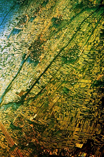
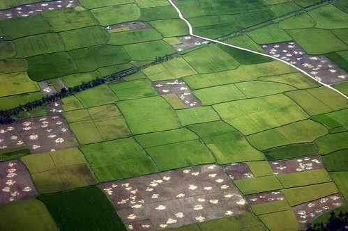
Canon EOS 350D Digital, 1/400s, f/8, 55mm, ISO 200
Laguna de Bay (?), Luzon, the Philippines
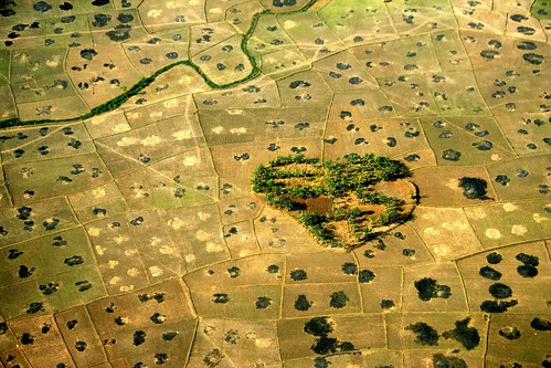
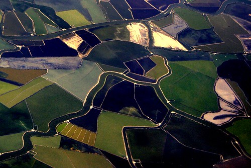
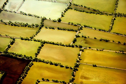
Canon EOS 350D Digital, 1/500s, f/5.6, 55mm, ISO 100, -2/3EV
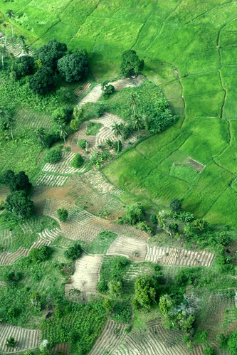
rice (?) fields at Makassar, South Sulawesi, Indonesia, July 31, 2008
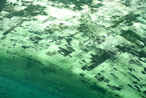
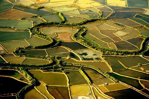
Canon EOS 350D Digital, 1/500s, f/8, 55mm, ISO 200
ponds near Surabaya, East Java, Indonesia, November 8, 2007
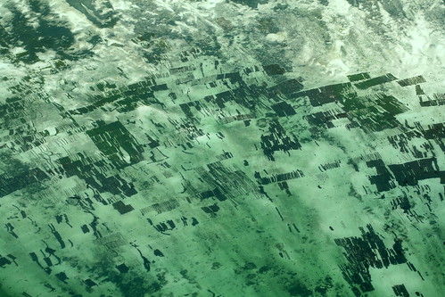
Canon EOS 350D Digital, 1/160s, f/8, 55mm, ISO 100, -1/3EV
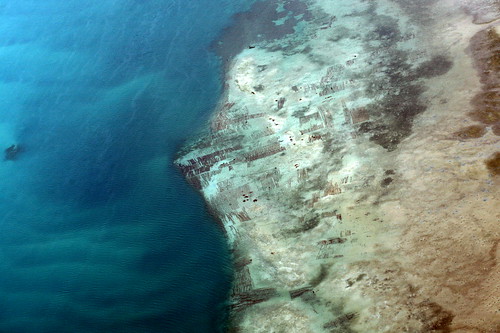
ponds in Makassar, South Sulawesi, Indonesia, September 13, 2006
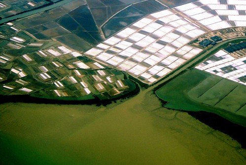
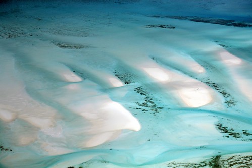
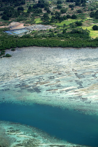
Canon EOS 350D Digital, 1/1500s, f/8, 55mm, ISO 100
salt farms in Madura, East Java, Indonesia, September 13, 2006
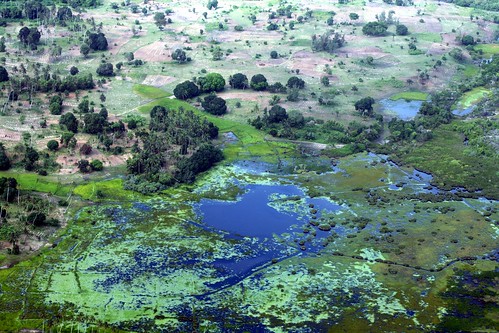
Canon EOS 350D Digital, 1/800s, f/9, 55mm, ISO 100
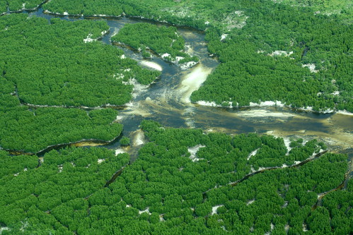
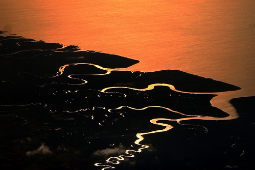
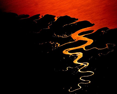
river tributaries in West Madagascar, East Africa, November 16, 2005
Canon EOS 350D Digital, 1/1000s, f/5.6, 55mm, ISO 200
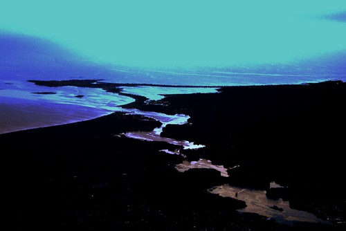
Biddeford Pool, Portland, Maine, the US, December 18, 2006
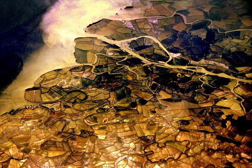
Canon EOS 350D Digital, 1/640s, f/5.6, 25mm, ISO 100, -1/3EV
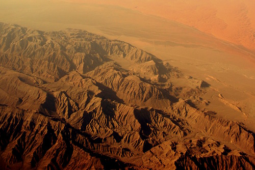
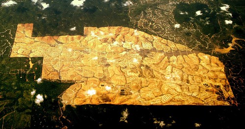
an unknown development project near Kuala Lumpur, Malaysia
Canon EOS 350D Digital, 1/640s, f/6.3, 55mm, ISO 100
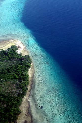
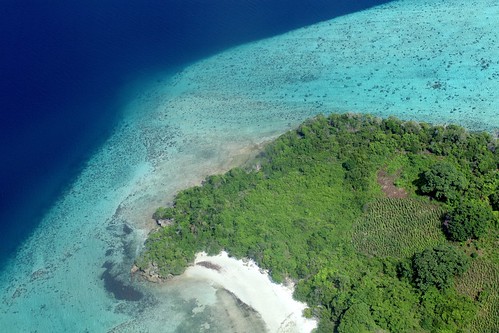
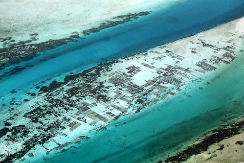
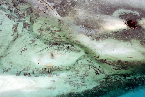
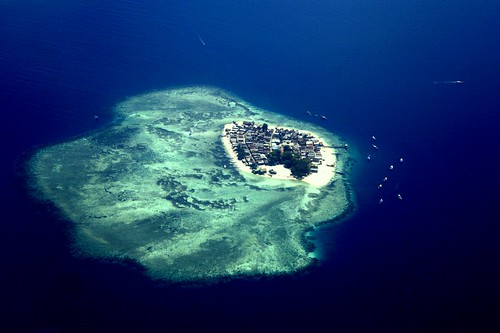
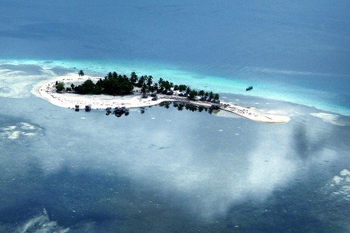
Tango Island, Bongao, Tawi-Tawi, the Philippines, March 27, 2006
Canon EOS 350D, 1/1000s, f/6.3, 51mm, ISO 100
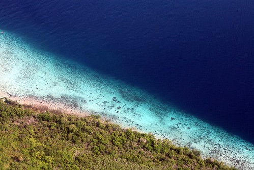
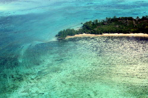
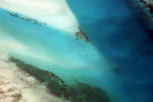
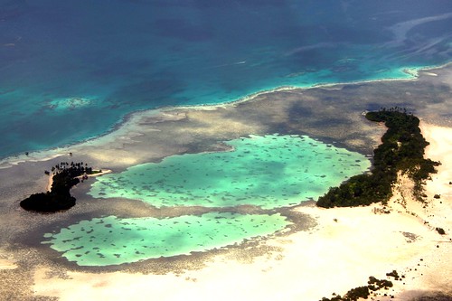
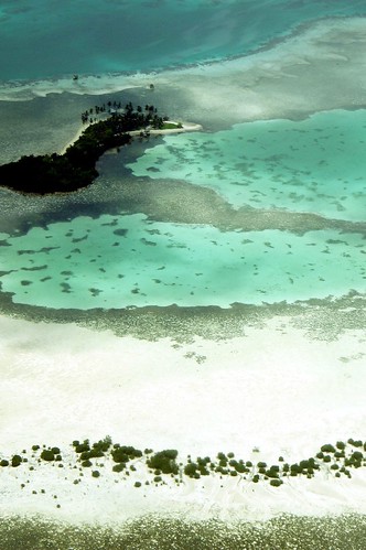
an islet near Bongao, Tawi-Tawi, the Autonomous Region of Muslim Mindanao, Sulu archipelago, the Philippines

Canon EOS 350D, 1/200s, f/11, 47mm, ISO 100
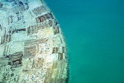
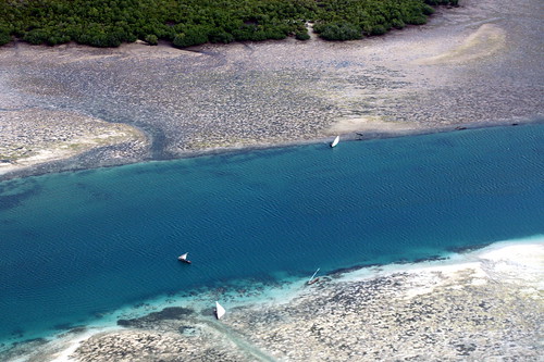
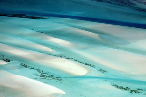
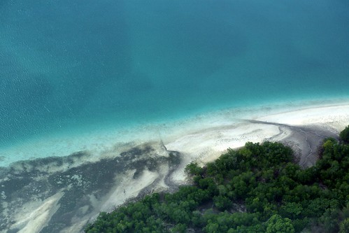
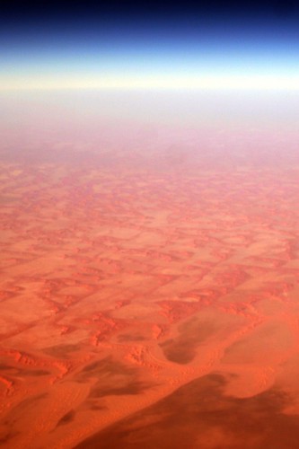
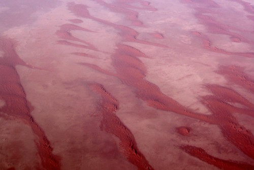
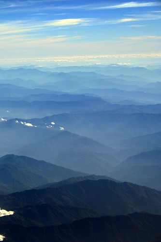
sanddunes north of Dar es Salaam, Tanzania, East Africa

Canon EOS 350D, 1/200s, f/11, 47mm, ISO 100
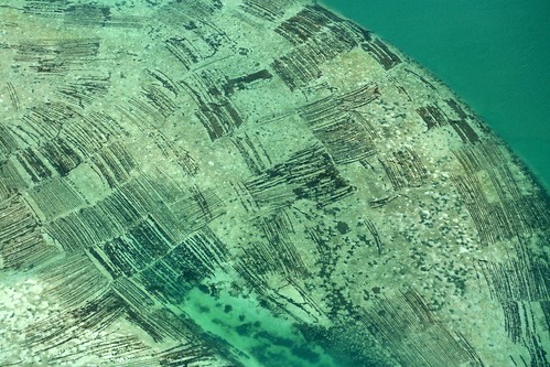
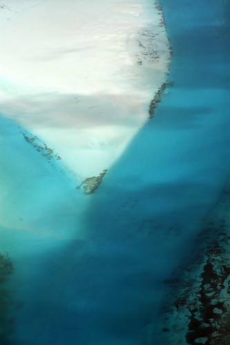
sanddunes north of Dar es Salaam, Tanzania, East Africa
For other aerial photos, check out My Islands of Sulu